Charette Lakes Wildlife Management Area: hunting and access
Charette Lakes Wildlife Management Area is 1,997 acres of State Wildlife Commission land in Unit 48, 12 miles from Wagon Mound, measured from NMDOW's Commission land map. NMDOW lists it as open to hunting. NMDOW's fact sheet: "Hunting is allowed by licensed and permitted hunters for waterfowl."
Data updated October 2026. Rules: NMDOW's fact sheet and Commission lands page, read 2026-10-18. Hunts: NMDOW's 2026-27 booklet. Boundary: NMDOW GIS.
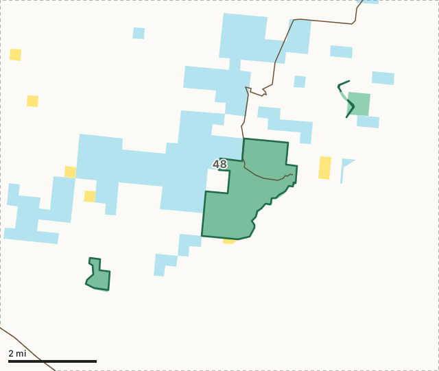
BLMState trust landWildlife Commission landCharette Lakes WMAUnit lineLake or riverHighway
| Size | 1,997 acres (NMDOW map) |
|---|---|
| Quadrant | Northeast New Mexico |
| Unit | Unit 48 |
| Open to | hunting, fishing and GAIN activities |
| Camping | Primitive camping is allowed March 1- October 31. |
| Motor vehicles | Not allowed beyond the roadway and parking area. |
| Nearest towns | Wagon Mound (12 mi), Springer (14 mi) and Cimarron (22 mi) |
What is Charette Lakes WMA like?
The property sits on top of Charette Mesa at 6,500 feet in elevation and contains two lakes. It is ringed by grasslands. Charette Lakes was purchased in 1949 to provide fishing opportunities and waterfowl resting areas.
From NMDOW fact sheet for Charette Lakes.
What are the rules on Charette Lakes WMA?
Closures: Charette Lakes Wildlife Area is open March 1-October 31. It is closed November 1 February 28 except for waterfowl hunting. Camping: Primitive camping is allowed March 1- October 31. Motor vehicles: Not allowed beyond the roadway and parking area.
Every Commission land needs a Habitat Management and Access Validation and the right license; WMAs are closed to hunting unless NMDOW's booklet lists them as open (NMDOW 2026-27 Hunting Rules and Information, page 49). Rules posted on the property also apply.
What can you hunt on Charette Lakes WMA?
NMDOW's fact sheet: Hunting is allowed by licensed and permitted hunters for waterfowl. The 2026-27 booklet names Charette Lakes in no big game hunt code; hunting follows the seasons of the unit it is in.
How do you get to Charette Lakes WMA?
Charette Lakes Wildlife Area is located north of Wagon Mound in Mora County.
Highways within 8 miles: US 85, I-25, NM 120 and NM 569. Nearest towns: Wagon Mound (12 miles), Springer (14 miles), Cimarron (22 miles) and Watrous (25 miles). Within 3 miles of the WMA, FilledTag measured 7,034 acres of other public land, most of it state trust land.
Which unit is Charette Lakes WMA in?
All of it is in Unit 48. Each unit's 2026-27 hunt codes and public land, for the whole unit:
| Unit | WMA acres in it | Unit public land | Elk codes | Deer codes | Pronghorn codes |
|---|---|---|---|---|---|
| Unit 48 | 1,997 | 29.1% | 7 | 4 | 5 |
Questions hunters ask
Can you hunt on Charette Lakes WMA?
Yes. NMDOW's Commission lands page lists Charette Lakes as open to hunting. Its fact sheet says: "Hunting is allowed by licensed and permitted hunters for waterfowl." Hunters need the proper license and the Habitat Management and Access Validation, and all WMAs are closed to hunting unless the booklet lists them as open (NMDOW 2026-27 Hunting Rules and Information, page 49).
When is Charette Lakes WMA closed?
Charette Lakes Wildlife Area is open March 1-October 31. It is closed November 1 February 28 except for waterfowl hunting. (NMDOW fact sheet for Charette Lakes). Rules posted on site also apply.
Can you camp on Charette Lakes WMA?
Primitive camping is allowed March 1- October 31. (NMDOW fact sheet for Charette Lakes)
Which unit is Charette Lakes WMA in?
All of Charette Lakes WMA is in Unit 48, by NMDOW's unit and Commission land maps.