Billingsley Creek Wildlife Management Area: hunting, access and rules
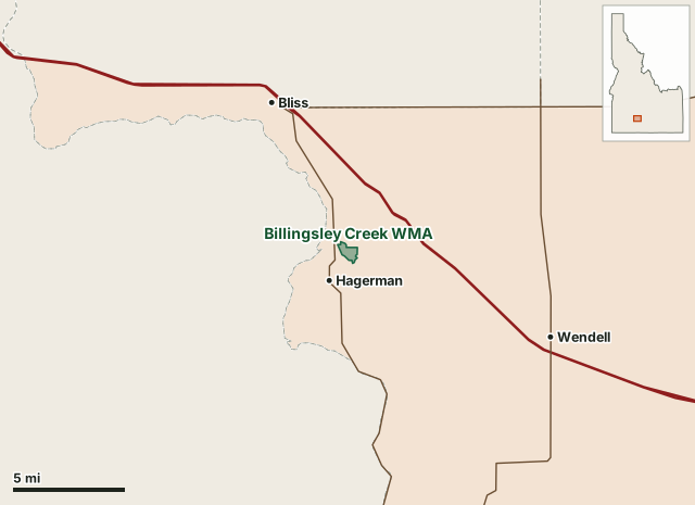
Billingsley Creek Wildlife Management Area is 275 acres in Gooding County, in Idaho Fish and Game's Magic Valley Region, inside game management unit 53, established in 1963. A spring-fed creek and wetland below the basalt rim of the Snake River Plain in the Hagerman Valley.
Data updated October 2026. Area facts: IDFG's page for Billingsley Creek WMA, read October 18, 2026. Outline: PAD-US. Harvest: IDFG harvest statistics, 2025.
| Size | 275 acres (IDFG) |
|---|---|
| County | Gooding County |
| Established | 1963 |
| IDFG region | Magic Valley |
| Game management unit | 53 |
| Elk zone | Big Desert |
| Primary purpose (IDFG) | Waterfowl and upland birds |
| Camping | IDFG lists no camping on the WMA |
What is Billingsley Creek WMA?
A spring-fed creek and wetland below the basalt rim of the Snake River Plain in the Hagerman Valley. Seven springs feed Billingsley Creek, which stays open for wintering waterfowl; the uplands hold pheasants and quail. IDFG bought the land from the McCarter Cattle Company in 1963, after its years as a sheep ranch, dairy and muskrat farm.
What can you hunt on Billingsley Creek WMA?
Open to hunting. Duck hunting is the main late-winter use when other water freezes, upland bird hunting is popular, and big game hunting is short-range weapons only.
IDFG lists these uses for the area: hunting, fishing, wildlife watching and trapping.
How do you get onto Billingsley Creek WMA, and when is it closed?
Boat access at two places: Billingsley Creek North, 2 miles northeast of Hagerman on US 30, and Billingsley Creek South, off 2650 South (Indian Springs Road) and 1050 East.
How many elk and deer are taken in the surrounding units?
IDFG counts harvest by unit, not by WMA. These are the whole units Billingsley Creek WMA lies in, for 2025:
| Unit | Elk harvested | Elk success | Deer harvested | Deer success |
|---|---|---|---|---|
| 53 | 34 | 11% | 115 | 27% |
General seasons, all weapons. Source: IDFG harvest statistics.
IDFG's maps and rules for Billingsley Creek WMA
Questions hunters ask
What can you hunt on Billingsley Creek WMA?
Open to hunting. Duck hunting is the main late-winter use when other water freezes, upland bird hunting is popular, and big game hunting is short-range weapons only. Seasons and tags follow the regulations for Unit 53.
Can you camp on Billingsley Creek WMA?
IDFG's page lists no camping on Billingsley Creek WMA.
How do you get onto Billingsley Creek WMA?
Boat access at two places: Billingsley Creek North, 2 miles northeast of Hagerman on US 30, and Billingsley Creek South, off 2650 South (Indian Springs Road) and 1050 East.
Which hunting unit is Billingsley Creek WMA in?
Unit 53, in the Big Desert elk zone.
Get your free Idaho plan
FilledTag plans Idaho's general elk and deer seasons: a specific, legal place to park, camp and sit for your tag and your dates, with the walks between them, checked against land records. The first 50 Idaho plans are free, one per hunter, for hunters who hold or will hold an Idaho general elk or deer tag. Every Idaho plan is looked over by a person before it is sent.
Get your free Idaho plan for unit 53 See a real plan
Not ready to order yet? Leave your email and you get one email when paid Idaho plans open, if the free ones have gone by then.
Where these facts come from
- Area description, rules, access, camping and uses: IDFG, Billingsley Creek WMA, written up by FilledTag in its own words.
- Outline: USGS Protected Areas Database (PAD-US), land managed by Idaho Fish and Game. Units: IDFG's unit boundaries.
- Harvest: IDFG harvest statistics.
FilledTag is not part of Idaho Fish and Game. WMA rules change: check IDFG's page and its posted rules before you go.