Wraco Lodge Lake Flooding State Wildlife Management Area: hunting and access
Wraco Lodge Lake Flooding State Wildlife Management Area is 2,019 acres of land the Michigan DNR manages for wildlife in Roscommon County, 4 miles from Houghton Lake, a state wildlife management area by the DNR's map. 359 acres are marked open to general hunting. Hunters reported 1,993 deer in Roscommon County in 2025.
Data updated October 2026. Area facts: the DNR's state game area data, read 2026-10. Harvest: DNR reported deer harvest, 2022 to 2025.
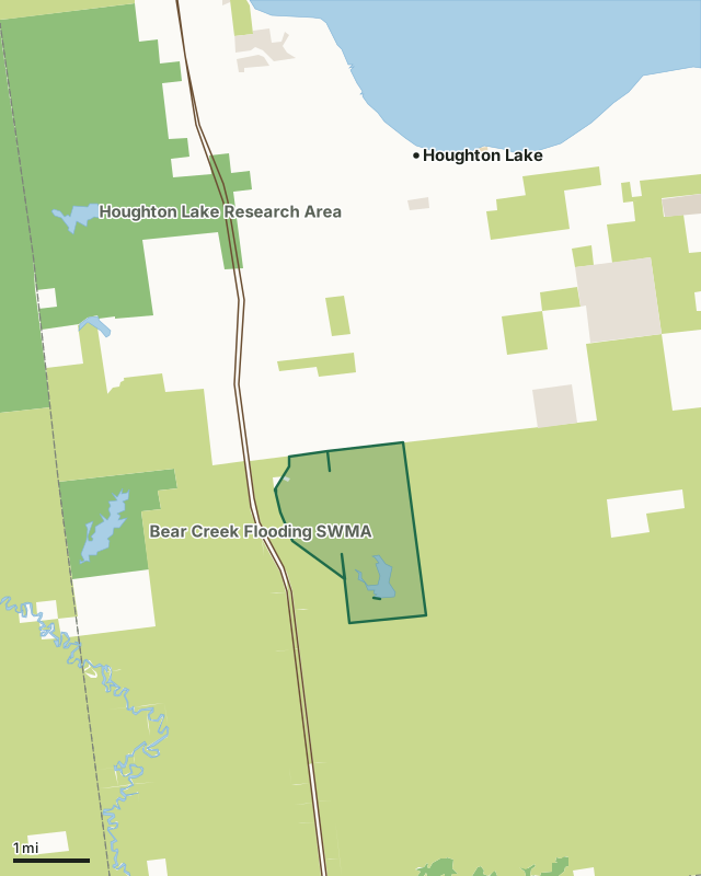
State game and wildlife areasState forest and other DNR landState parks and recreation areasCounty, city and regional landLand trusts and other open landWraco Lodge Lake Flooding State Wildlife Management AreaCounty lineLakeHighway
| Size | 2,019 acres |
|---|---|
| County | Roscommon County |
| Deer harvest unit | Roscommon County |
| Kind (DNR) | state wildlife management area |
| DNR region | Northern Lower Peninsula |
| No hunting or safety zone | 1,660 acres (82.2%) |
| Open to general hunting | 359 acres (17.8%) |
| Nearest towns | Houghton Lake (4 mi), Prudenville (6 mi) and Falmouth (14 mi) |
What are the rules on Wraco Lodge Lake Flooding State Wildlife Management Area?
The DNR's map marks each piece of Wraco Lodge Lake Flooding State Wildlife Management Area: 1,660 acres no hunting or safety zone and 359 acres open to general hunting.
No-hunting and safety-zone pieces are posted; Michigan's 450-foot safety zone around occupied buildings applies everywhere.
How many deer are taken around Wraco Lodge Lake Flooding State Wildlife Management Area?
Wraco Lodge Lake Flooding State Wildlife Management Area lies in Roscommon County. Hunters reported 1,993 deer in Roscommon County in 2025, against 2,201 in 2024.
| County | Wraco Lodge Lake Flooding State Wildlife Management Area acres in it | Deer, 2025 | Deer, 2024 | Deer, 2023 |
|---|---|---|---|---|
| Roscommon County | 2,019 | 1,993 | 2,201 | 2,013 |
Harvest for the whole county, not the game area alone: Michigan DNR reported deer harvest (license years 2022 to 2025).
How do you get to Wraco Lodge Lake Flooding State Wildlife Management Area?
Nearest towns: Houghton Lake (4 miles), Prudenville (6 miles), Falmouth (14 miles) and Harrison (14 miles). Highways within 5 miles: US 27.
What other public land is near Wraco Lodge Lake Flooding State Wildlife Management Area?
DNR wildlife areas and parks open to hunting within 10 miles:
- Bear Creek Flooding State Wildlife Management Area: 943 acres, 1.3 miles away
- Houghton Lake State Wildlife Research Area: 12,141 acres, 2.3 miles away
- Townline Creek Flooding State Wildlife Management Area: 663 acres, 3.2 miles away
- Houghton Lake Flats South Flooding State Wildlife Management Area: 992 acres, 6.6 miles away
- Dead Stream Flooding State Wildlife Management Area: 1,024 acres, 8.2 miles away
- Gladwin Field Trial Area and Wildlife Unit of State Forest: 4,753 acres, 8.5 miles away
Public land within 3 miles of Wraco Lodge Lake Flooding State Wildlife Management Area
Counting Wraco Lodge Lake Flooding State Wildlife Management Area itself, 24,002 of the 34,081 acres within 3 miles of its boundary are public land open to the public (70.4%), by USGS PAD-US 4.1 and the DNR's state forest records.
| Manager | Acres within 3 miles |
|---|---|
| State forest and other DNR land | 22,644 |
| State game and wildlife areas | 1,133 |
| Land trusts and other open land | 225 |
Questions hunters ask
Where is Wraco Lodge Lake Flooding State Wildlife Management Area?
In Roscommon County, 4 miles from Houghton Lake.
How much of Wraco Lodge Lake Flooding State Wildlife Management Area is open to hunting?
359 acres are marked general hunting, and 1,660 acres are no-hunting or safety zones, by the DNR's map.
How much public land is around Wraco Lodge Lake Flooding State Wildlife Management Area?
24,002 acres within 3 miles of its boundary, Wraco Lodge Lake Flooding State Wildlife Management Area included, by USGS PAD-US 4.1 and the DNR's state forest records. The closest other DNR area or park is Bear Creek Flooding State Wildlife Management Area (1.3 miles).
Get a Michigan hunt plan when they open
Hunt plans for Michigan are coming. Join the list and you'll hear first. The first 50 hunters in each new state get their plan free.
Until then, the free FilledTag app for iPhone has a map that works in every state, Michigan included.
Where these facts come from
- Area description, species, rules and directions: Michigan DNR wildlife property project areas.
- Boundary and acres: the DNR's map layer above. Surrounding public land: USGS PAD-US 4.1 (fee land open to the public) and the DNR's land ownership records (state forest).
- Deer harvest: Michigan DNR reported deer harvest (license years 2022 to 2025).
FilledTag is not part of the Michigan Department of Natural Resources. Check the DNR's rules and posted signs before you go.