Capps Creek Conservation Area: hunting and access
Capps Creek Conservation Area is 725 acres of MDC land in Newton County, 5 miles from Fairview. MDC lists deer hunting here (muzzleloader and archery, antlerless permits allowed). Hunters checked 2,890 deer in Newton County in 2025.
Data updated October 2026. Area facts: MDC's conservation area data, read 2026-10. Harvest: MDC deer harvest summaries, 2021 to 2025.
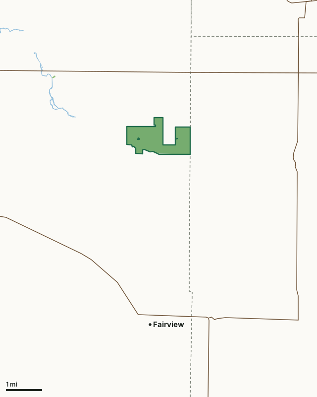
MDC conservation areasCapps Creek Conservation AreaCounty lineLakeHighway
| Size | 725 acres |
|---|---|
| County | Newton County |
| Deer harvest unit | Newton County |
| MDC lists for hunting | Deer, Bear, Turkey, Rabbit, Squirrel and Dove |
| MDC area number | 9725 |
| MDC region | Southwest |
| Nearest towns | Fairview (5 mi), Newtonia (5 mi) and Pierce City (5 mi) |
What is Capps Creek Conservation Area like?
Capps Creek Conservation Area occupies 729 acres along the Eastern border of Newton County. Capps Creek, which is classified as a White Ribbon Trout Stream, receives most of its year-round flow from springs, creating a coldwater stream that has provided a trout fishing opportunity for more than 30 years.
The area is made up of small, wet bottomlands and rolling upland forests and grasslands. The Conservation Department's multi-use management strategy provides increased opportunities for wildlife viewing, fishing, hunting, and other recreational activities. Management activities on Capps Creek Conservation Area include: prescribed burning, haying, planting food plots and native grass mixes, and timber stand improvement through thinning and commercial harvest. Sharecropping agreements with selected area farmers result in grain crops left in the field for wildlife use during winter months.
In MDC's words, from the Capps Creek Conservation Area page.
What can you hunt on Capps Creek Conservation Area?
MDC's page for Capps Creek Conservation Area lists: Deer: muzzleloader and archery, antlerless permits allowed; Bear: archery and firearms; Turkey: archery and firearms; Rabbit; Squirrel; Dove.
What are the rules on Capps Creek Conservation Area?
MDC's standard conservation area rules (Chapter 11 of the Wildlife Code) apply; the area's rules on MDC's site list any it adds.
How many deer are taken around Capps Creek Conservation Area?
Capps Creek Conservation Area lies in Newton County. Hunters checked 2,890 deer in Newton County in 2025, against 2,789 in 2024.
| County | Capps Creek Conservation Area acres in it | Deer, 2025 | Deer, 2024 | Deer, 2023 |
|---|---|---|---|---|
| Newton County | 724 | 2,890 | 2,789 | 3,043 |
Harvest for the whole county, not the conservation area alone: MDC deer harvest summaries (2021 to 2025 seasons).
How do you get to Capps Creek Conservation Area?
MDC's directions: From Monett, take Highway 60 west 7.50 miles, then Wallaby Road south 1.75 miles to its junction with Jolly Mill Drive.
Nearest towns: Fairview (5 miles), Newtonia (5 miles), Pierce City (5 miles) and Stark City (5 miles). Highways within 5 miles: US 60, MO 97, MO 86 and MO 37.
What other public land is near Capps Creek Conservation Area?
Public land within 3 miles of Capps Creek Conservation Area
Counting Capps Creek Conservation Area itself, 731 of the 28,561 acres within 3 miles of its boundary are public land open to the public (2.6%), by USGS PAD-US 4.1 and MDC conservation area boundaries.
| Manager | Acres within 3 miles |
|---|---|
| MDC conservation areas | 731 |
Questions hunters ask
Where is Capps Creek Conservation Area?
In Newton County, 5 miles from Fairview.
Can you deer hunt on Capps Creek Conservation Area?
Yes, by MDC's page: muzzleloader and archery, antlerless permits allowed.
How much public land is around Capps Creek Conservation Area?
731 acres within 3 miles of its boundary, Capps Creek Conservation Area included, by USGS PAD-US 4.1 and MDC conservation area boundaries.
Get a Missouri hunt plan when they open
Hunt plans for Missouri are coming. Join the list and you'll hear first. The first 50 hunters in each new state get their plan free.
Until then, the free FilledTag app for iPhone has a map that works in every state, Missouri included.
Where these facts come from
- Area description, species, rules and directions: MDC, Capps Creek Conservation Area; MDC conservation area boundaries.
- Boundary and acres: MDC's map layer above. Surrounding public land: USGS PAD-US 4.1 (fee land open to the public) and MDC conservation area boundaries.
- Deer harvest: MDC deer harvest summaries (2021 to 2025 seasons).
FilledTag is not part of the Missouri Department of Conservation. Check MDC's rules and posted signs before you go.