Dan and Maureen Cover Prairie Conservation Area: hunting and access
Dan and Maureen Cover Prairie Conservation Area is 744 acres of MDC land in Howell County, 2 miles from Koshkonong. MDC lists deer hunting here (archery only, antlerless permits allowed). Hunters checked 5,474 deer in Howell County in 2025.
Data updated October 2026. Area facts: MDC's conservation area data, read 2026-10. Harvest: MDC deer harvest summaries, 2021 to 2025.
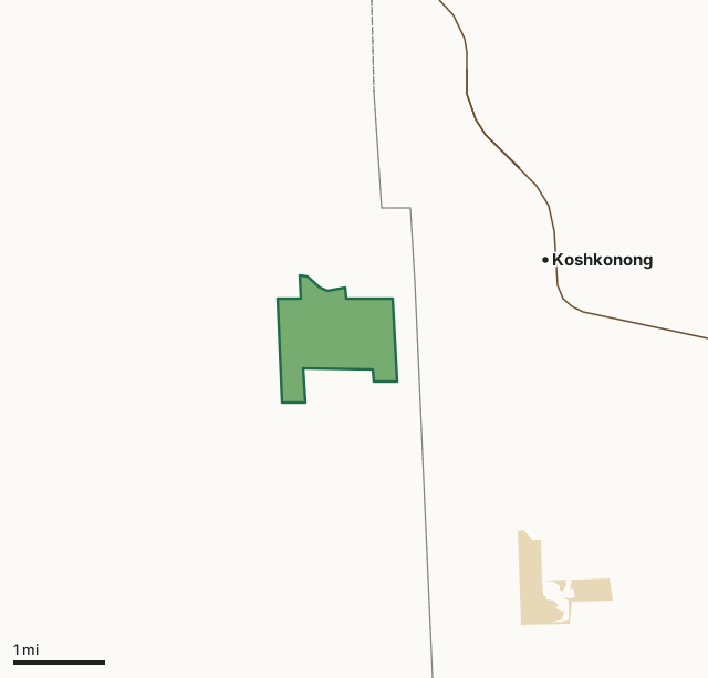
MDC conservation areasState parks and historic sitesDan and Maureen Cover Prairie Conservation AreaCounty lineHighway
| Size | 744 acres |
|---|---|
| County | Howell County |
| Deer harvest unit | Howell County |
| MDC lists for hunting | Deer, Bear, Turkey, Rabbit, Squirrel and Quail |
| MDC area number | 200113 |
| MDC region | Ozark |
| Nearest towns | Koshkonong (2 mi), Brandsville (4 mi) and Thayer (8 mi) |
What is Dan and Maureen Cover Prairie Conservation Area like?
Cover Prairie Conservation Area is in southeast Howell County, about three miles east of Koshkonong, off of Route F.
About 60 percent of the area is dominated by grass herbaceous cover. The remaining open land is a mixture of hardwood shrubs and soft mast, such as blackberry bushes. A small portion of the area is covered by dry-mesic chert woodland with the predominant tree species being blackjack, post oak, and hickory. Cover Prairie Conservation Area is characterized as a heavy karst field with many sinkholes. All of the surface water flows either into local sinkholes or runs into the Grand Gulf and re-emerges at Mammoth Spring, Arkansas. Dan Cover purchased the land in 1988, before which the area had been cleared and used for raising swine. After Mr. Cover acquired this property, he created an early successional community through the use of prescribed fire, warm-season grass plantings, and removal of exotic plant species. In 2001, Dan Cover donated this property to the Missouri Department of...
In MDC's words, from the Dan and Maureen Cover Prairie Conservation Area page.
What can you hunt on Dan and Maureen Cover Prairie Conservation Area?
MDC's page for Dan and Maureen Cover Prairie Conservation Area lists: Deer: archery only, antlerless permits allowed; Bear: archery and firearms; Turkey: archery and firearms; Rabbit; Squirrel; Quail.
What are the rules on Dan and Maureen Cover Prairie Conservation Area?
MDC's standard conservation area rules (Chapter 11 of the Wildlife Code) apply; the area's rules on MDC's site list any it adds.
How many deer are taken around Dan and Maureen Cover Prairie Conservation Area?
Dan and Maureen Cover Prairie Conservation Area lies in Howell County. Hunters checked 5,474 deer in Howell County in 2025, against 4,476 in 2024.
| County | Dan and Maureen Cover Prairie Conservation Area acres in it | Deer, 2025 | Deer, 2024 | Deer, 2023 |
|---|---|---|---|---|
| Howell County | 744 | 5,474 | 4,476 | 6,346 |
Harvest for the whole county, not the conservation area alone: MDC deer harvest summaries (2021 to 2025 seasons).
How do you get to Dan and Maureen Cover Prairie Conservation Area?
MDC's directions: From West Plains, take Highway 63 south to Koshkonong, take Route F west 3 miles to Cover Prairie on the south side of Route F.
Nearest towns: Koshkonong (2 miles), Brandsville (4 miles), Thayer (8 miles) and West Plains (14 miles). Highways within 5 miles: US 63, MO 142 and US 160.
What other public land is near Dan and Maureen Cover Prairie Conservation Area?
MDC lands within 10 miles:
- White Ranch Conservation Area: 6,694 acres, 4.7 miles away
- Warm Fork Conservation Area: 162 acres, 6.2 miles away
- Tingler Prairie Conservation Area: 254 acres, 9.1 miles away
Public land within 3 miles of Dan and Maureen Cover Prairie Conservation Area
Counting Dan and Maureen Cover Prairie Conservation Area itself, 917 of the 28,039 acres within 3 miles of its boundary are public land open to the public (3.3%), by USGS PAD-US 4.1 and MDC conservation area boundaries.
| Manager | Acres within 3 miles |
|---|---|
| MDC conservation areas | 744 |
| State parks and historic sites | 173 |
Questions hunters ask
Where is Dan and Maureen Cover Prairie Conservation Area?
In Howell County, 2 miles from Koshkonong.
Can you deer hunt on Dan and Maureen Cover Prairie Conservation Area?
Yes, by MDC's page: archery only, antlerless permits allowed.
How much public land is around Dan and Maureen Cover Prairie Conservation Area?
917 acres within 3 miles of its boundary, Dan and Maureen Cover Prairie Conservation Area included, by USGS PAD-US 4.1 and MDC conservation area boundaries. The closest other MDC area is White Ranch Conservation Area (4.7 miles).
Get a Missouri hunt plan when they open
Hunt plans for Missouri are coming. Join the list and you'll hear first. The first 50 hunters in each new state get their plan free.
Until then, the free FilledTag app for iPhone has a map that works in every state, Missouri included.
Where these facts come from
- Area description, species, rules and directions: MDC, Dan and Maureen Cover Prairie Conservation Area; MDC conservation area boundaries.
- Boundary and acres: MDC's map layer above. Surrounding public land: USGS PAD-US 4.1 (fee land open to the public) and MDC conservation area boundaries.
- Deer harvest: MDC deer harvest summaries (2021 to 2025 seasons).
FilledTag is not part of the Missouri Department of Conservation. Check MDC's rules and posted signs before you go.