McClure Conservation Area: hunting and access
McClure Conservation Area is 240 acres of MDC land in Mercer County, 5 miles from Spickard. MDC lists deer hunting here (archery and firearms, antlerless permits allowed). Hunters checked 2,036 deer in Mercer County in 2025.
Data updated October 2026. Area facts: MDC's conservation area data, read 2026-10. Harvest: MDC deer harvest summaries, 2021 to 2025.
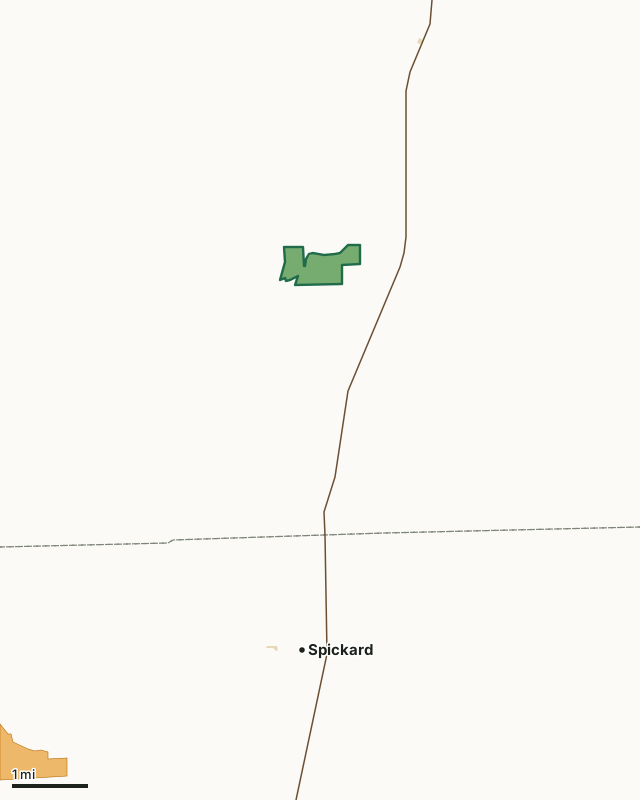
MDC conservation areasState parks and historic sitesMRAP landMcClure Conservation AreaCounty lineHighway
| Size | 240 acres |
|---|---|
| County | Mercer County |
| Deer harvest unit | Mercer County |
| MDC lists for hunting | Deer, Turkey, Rabbit and Squirrel |
| MDC area number | 200813 |
| MDC region | Northwest |
| Nearest towns | Spickard (5 mi), Princeton (5 mi) and Tindall (11 mi) |
What is McClure Conservation Area like?
The original 232 acre tract was donated to the Conservation Department by the late Leafa McClure back in 1984. After the death of her last surviving heir, son J.W. McClure of Trenton, MO, the area was officially transferred to the Department in November of 2007. An additional 6.7 acres on the west side of the area was purchased from Charles Girdner of Iowa in 2008 expanding the size of the area to it's current size.
A portion of the Weldon Fork of the Grand River bisects the area for over a mile. McClure Conservation Area will be managed primarily by permittee haying, row crop farming, and food plots.
In MDC's words, from the McClure Conservation Area page.
What can you hunt on McClure Conservation Area?
MDC's page for McClure Conservation Area lists: Deer: archery and firearms, antlerless permits allowed; Turkey: archery and firearms; Rabbit; Squirrel.
What are the rules on McClure Conservation Area?
MDC's standard conservation area rules (Chapter 11 of the Wildlife Code) apply; the area's rules on MDC's site list any it adds.
How many deer are taken around McClure Conservation Area?
McClure Conservation Area lies in Mercer County. Hunters checked 2,036 deer in Mercer County in 2025, against 2,044 in 2024.
| County | McClure Conservation Area acres in it | Deer, 2025 | Deer, 2024 | Deer, 2023 |
|---|---|---|---|---|
| Mercer County | 240 | 2,036 | 2,044 | 2,109 |
Harvest for the whole county, not the conservation area alone: MDC deer harvest summaries (2021 to 2025 seasons).
How do you get to McClure Conservation Area?
MDC's directions: From Princeton, take Highway 65 south 6 miles, then Route D west approximately 1 mile, then Icabod Place (gravel) north 0.25 mile where Icabod Place dead ends at area parking lot.
Nearest towns: Spickard (5 miles), Princeton (5 miles), Tindall (11 miles) and Mount Moriah (11 miles). Highways within 5 miles: US 65.
What other public land is near McClure Conservation Area?
MDC lands within 10 miles:
- Lake Paho Conservation Area: 2,361 acres, 6.1 miles away
- Chloe Lowry Marsh Natural Area: 113 acres, 7.6 miles away
Public land within 3 miles of McClure Conservation Area
Counting McClure Conservation Area itself, 243 of the 23,880 acres within 3 miles of its boundary are public land open to the public (1%), by USGS PAD-US 4.1 and MDC conservation area boundaries.
| Manager | Acres within 3 miles |
|---|---|
| MDC conservation areas | 241 |
| State parks and historic sites | 2 |
Questions hunters ask
Where is McClure Conservation Area?
In Mercer County, 5 miles from Spickard.
Can you deer hunt on McClure Conservation Area?
Yes, by MDC's page: archery and firearms, antlerless permits allowed.
How much public land is around McClure Conservation Area?
243 acres within 3 miles of its boundary, McClure Conservation Area included, by USGS PAD-US 4.1 and MDC conservation area boundaries. The closest other MDC area is Lake Paho Conservation Area (6.1 miles).
Get a Missouri hunt plan when they open
Hunt plans for Missouri are coming. Join the list and you'll hear first. The first 50 hunters in each new state get their plan free.
Until then, the free FilledTag app for iPhone has a map that works in every state, Missouri included.
Where these facts come from
- Area description, species, rules and directions: MDC, McClure Conservation Area; MDC conservation area boundaries.
- Boundary and acres: MDC's map layer above. Surrounding public land: USGS PAD-US 4.1 (fee land open to the public) and MDC conservation area boundaries.
- Deer harvest: MDC deer harvest summaries (2021 to 2025 seasons).
FilledTag is not part of the Missouri Department of Conservation. Check MDC's rules and posted signs before you go.