Wright County, Minnesota: public hunting land
Wright County has 13,471 acres of public land open to the public, 2.9% of the county, the largest share state wildlife management areas (6,333 acres), by USGS PAD-US 4.1 (fee land open to the public). The DNR's map shows 17 wildlife management areas here covering 6,234 acres, the largest Pelican Lake WMA (1,017 acres in the county). Deer here are counted by deer permit area: DPA 229 (1,039 deer in 2025), DPA 219 (1,989 deer in 2025), DPA 685 and DPA 601 (2,588 deer in 2025).
Data updated October 2026. Land: PAD-US 4.1. Wildlife Management Areas and Walk-In Access: the DNR's map layers, read 2026-10. Harvest: DNR Deer Harvest Reports, 2021 to 2025.
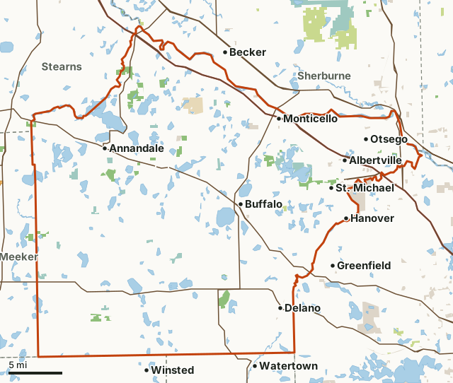
State wildlife management areasState forest and other DNR landNational wildlife refuges and waterfowl production areasState parksCounty, city and regional landLand trusts and other open landWalk-In AccessWright CountyNeighboring countiesLakeHighway
| Size | 457,161 acres (714 square miles) |
|---|---|
| Public land | 2.9% (13,471 acres) |
| WMAs | 17 (6,234 acres) |
| Walk-In Access | None mapped this year |
| Deer permit areas | DPA 229, DPA 219, DPA 685, DPA 601 |
| Towns | St. Michael, Otsego, Monticello, Buffalo, Watertown and Becker |
How much public hunting land is in Wright County?
13,471 of the county's 457,161 acres are public land open to the public (2.9%). 9,969 acres of that are state wildlife, state forest or federal land, where hunting is the rule rather than the exception.
| Manager | Acres | Share of Wright County |
|---|---|---|
| State wildlife management areas | 6,333 | 1.4% |
| National wildlife refuges and waterfowl production areas | 3,401 | 0.7% |
| County, city and regional land | 1,883 | 0.4% |
| State parks | 1,591 | 0.3% |
| State forest and other DNR land | 234 | 0.1% |
| Land trusts and other open land | 28 | under 0.1% |
| Other federal land | 1 | under 0.1% |
| All public land open to the public | 13,471 | 2.9% |
Measured by FilledTag inside the county line from USGS PAD-US 4.1 (fee land open to the public). State wildlife management areas, state forest land and national forests are open to hunting in season; refuges and waterfowl production areas follow U.S. Fish and Wildlife Service rules; state parks allow hunting only in special hunts; national park land is closed to hunting; city and county parks set their own rules. PAD-US 4.1 leaves out most of the tax-forfeited land Minnesota counties manage, much of it open to hunting, so the public land here may be more than shown; the county land department has the maps.
The largest public areas in Wright County by PAD-US, besides the WMAs: Wright County Waterfowl Production Area (3,394 acres) and Bertram Chain of Lakes Regional Park (321 acres).
Which wildlife management areas are in Wright County?
17, largest first.
| WMA | Acres in the county | DNR lists for hunting |
|---|---|---|
| Pelican Lake WMA | 1,017 | deer, wild turkey, pheasants, ducks and geese, ruffed grouse and other forest upland birds and mourning doves |
| Suconnix WMA | 1,007 | deer, wild turkey, pheasants, ducks and geese, ruffed grouse and other forest upland birds and small game |
| Woodland WMA | 723 | deer, pheasants, ducks and geese and small game |
| Albion WMA | 546 | deer, wild turkey, pheasants, ducks and geese and small game |
| Minnesota Veterans WMA | 494 | deer, wild turkey, pheasants, ducks and geese, ruffed grouse and other forest upland birds and mourning doves |
| Grass Lake WMA | 478 | deer, pheasants, ducks and geese and small game |
| Maple Lake WMA | 410 | deer, wild turkey, pheasants, ducks and geese, ruffed grouse and other forest upland birds and small game |
| Hoglund WMA | 362 | deer, wild turkey, pheasants, ducks and geese, ruffed grouse and other forest upland birds and small game |
| St. Michael Meadows WMA | 211 | deer, pheasants and ducks and geese |
| Otsego WMA | 205 | deer, wild turkey, pheasants, ducks and geese, ruffed grouse and other forest upland birds and small game |
| Knapp WMA | 197 | deer, pheasants, ducks and geese and small game |
| Kelly-meyer WMA | 136 | deer, pheasants, ducks and geese and small game |
| Malardi Lake WMA | 125 | deer, pheasants, ducks and geese and small game |
| Swartout WMA | 110 | deer, pheasants, ducks and geese and small game |
| A Shau Valley WMA | 93 | deer, wild turkey, pheasants, ducks and geese, ruffed grouse and other forest upland birds and small game |
| Corinna WMA | 81 | deer, wild turkey, pheasants, ducks and geese and small game |
| Hidden Marsh WMA | 39 | deer, wild turkey, pheasants, ducks and geese and small game |
How many deer are taken in Wright County?
The DNR counts deer by permit area, not by county. Wright County lies in 4 permit areas; the largest share is in DPA 229 (43.5% of the county). Each figure below is for the whole permit area.
| DPA | Share of the county | Deer harvested in the whole DPA | Year |
|---|---|---|---|
| DPA 229 | 43.5% | 1,039 | 2025 |
| DPA 219 | 36.2% | 1,989 | 2025 |
| DPA 685 | 19.2% | ||
| DPA 601 | 1.1% | 2,588 | 2025 |
Harvest: Minnesota DNR Deer Harvest Reports (2021 to 2025, 2025 report). Share of the county measured by FilledTag from the DNR's deer permit areas and the Census county line.
How do you get around Wright County?
Highways: I-94 (about 54 miles in the county), US 52 (about 54 miles in the county), MN 55 (about 34 miles in the county), MN 25 (about 27 miles in the county) and US 12 (about 26 miles in the county). Towns: St. Michael, Otsego, Monticello, Buffalo, Hanover, Delano, Albertville and Annandale.
Questions hunters ask
What is the largest public land in Wright County besides the WMAs?
By PAD-US 4.1: Wright County Waterfowl Production Area (3,394 acres in the county) and Bertram Chain of Lakes Regional Park (321 acres in the county). The largest kind of public land here is state wildlife management areas, 6,333 acres.
What is the largest WMA in Wright County?
Pelican Lake WMA, with 1,017 acres inside the county. The county has 17 WMAs in all.
Does Wright County have Walk-In Access land?
Not on the DNR's 2026 Walk-In Access map. The program is mostly in western and southern Minnesota.
Which deer permit area is Wright County in?
DPA 229 (43.5%), DPA 219 (36.2%), DPA 685 (19.2%) and DPA 601 (1.1%). Bag limits and firearms dates follow the permit area.
Get a Minnesota hunt plan when they open
Hunt plans for Minnesota are coming. Join the list and you'll hear first. The first 50 hunters in each new state get their plan free.
Until then, the free FilledTag app for iPhone has a map that works in every state, Minnesota included.
Where these numbers come from
- Public land: USGS PAD-US 4.1 (fee land open to the public). Wildlife Management Areas: Minnesota DNR Wildlife Management Area boundaries, publicly accessible. Walk-In Access: Minnesota DNR Walk-In Access sites.
- Deer harvest: Minnesota DNR Deer Harvest Reports (2021 to 2025, 2025 report).
- County line: U.S. Census Bureau 2024 cartographic county boundaries. Highways and towns: U.S. Census Bureau TIGER/Line 2024 primary and secondary roads.
FilledTag is not part of the Minnesota Department of Natural Resources. Numbers are copied from the DNR and the federal sources above, or measured from their maps.
Minnesota hunting DPA 229 DPA 219 Carver County McLeod County Meeker County Stearns County Hennepin County Sherburne County