Pine Creek Access Area: hunting access, rules and map
The Pine Creek Access Area opens 11,995 acres to public hunting through ODFW's Access and Habitat program, in the Malheur River Unit (66). ODFW lists it as "Welcome to Hunt".
Data updated October 2026. Area, access type and rules: ODFW's Access and Habitat layer for the Oregon Hunting Access Map. Land around it: USGS PAD-US 4.1.
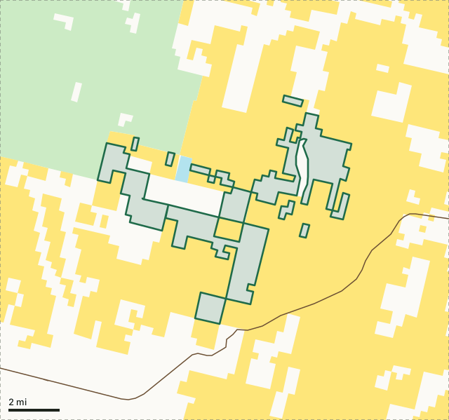
National wildlife refugeNational forestBLMODFW landState forest and trust landPine Creek Access AreaUnit lineLake, reservoir or riverHighway
| Open to hunting | 11,995 acres |
|---|---|
| Access | Welcome to Hunt |
| Units | 66 Malheur River |
| ODFW region | Southeast |
| Nearest towns | Crane (17 mi), Burns (19 mi) and Hines (21 mi) |
What is the Pine Creek Access Area?
The Pine Creek Access Area is a cooperative program between a private landowner and the Oregon Department of Fish and Wildlife Access and Habitat Program to allow public hunting opportunities for deer, elk, pronghorn, and predators. All Oregon Department of Fish and Wildlife regulations and seasons apply.
What are the rules on the Pine Creek Access Area?
- No camping or night time use of private land.
- No fires, be careful with cigarettes.
- No littering, please pick up any trash including expended shells.
- Report any unlawful activities.
- Respect landowner's rights and needs.
- Leave gates as you found them.
- Vehicle travel only on roads mapped and posted as open access road.
ODFW's description and rules, from ODFW Access and Habitat areas (Oregon Hunting Access Map layer). ODFW's area map: Pine Creek map (PDF). The program: ODFW Access and Habitat.
Which units is the Pine Creek Access Area in?
| Unit | Area acres in it, all zones | Elk harvested (unit) | Deer harvested (unit) | Public land (unit) |
|---|---|---|---|---|
| Unit 66 Malheur River | 11,995 | 266 (2025) | 490 (2025) | 67.7% |
Harvest: ODFW harvest statistics (2020 to 2025), for the whole unit. Acres measured by FilledTag from ODFW's boundaries; public land from USGS PAD-US 4.1 (fee land by manager, 2025).
How do you get to the Pine Creek Access Area?
Highways within 8 miles: US 20. Nearest towns: Crane (17 miles), Burns (19 miles), Hines (21 miles) and Juntura (23 miles). ODFW's area map shows the roads in.
Questions hunters ask
Do you need permission to hunt the Pine Creek Access Area?
ODFW lists the area as "Welcome to Hunt". No camping or night time use of private land.
Which unit is the Pine Creek Access Area in?
The Malheur River Unit (66).
What can you hunt on the Pine Creek Access Area?
ODFW's description: The Pine Creek Access Area is a cooperative program between a private landowner and the Oregon Department of Fish and Wildlife Access and Habitat Program to allow public hunting opportunities for deer, elk, pronghorn, and predators.
Get an Oregon hunt plan when they open
Hunt plans for Oregon are coming. Join the list and you'll hear first. The first 50 hunters in each new state get their plan free.
Until then, the free FilledTag app for iPhone has a map that works in every state, Oregon included.
Where these facts come from
- Area, zones, access type, description and rules: ODFW Access and Habitat areas (Oregon Hunting Access Map layer).
- Surrounding public land: USGS PAD-US 4.1 (fee land by manager, 2025). Unit harvest: ODFW harvest statistics (2020 to 2025).
FilledTag is not part of Oregon Department of Fish and Wildlife. Access areas are private land: follow ODFW's rules for each one.