Candy Cain Abshier WMA: access, rules and map
Candy Cain Abshier WMA is 207 acres in Chambers County, owned or managed by TPWD. It has no page in TPWD's 2026-27 Map Booklet for Public Hunting Lands, so the Annual Public Hunting Permit alone does not open it to walk-in hunting. When it is open, in TPWD's words: Open year round.
Data updated October 2026. Area facts: TPWD's page for Candy Cain Abshier WMA. Boundary: TPWD's WMA layer.
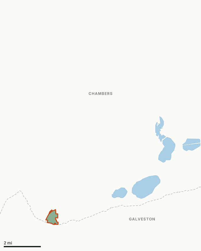
This areaOther public hunting landCounty lineLake or riverHighway
| Size | 207 acres (TPWD); 216 acres mapped |
|---|---|
| County | Chambers County |
| Walk-in hunting on the APH permit | No booklet page for 2026-27 |
| When it is open | Open year round. |
| Area office | (409) 736-2551 |
| Towns | Texas City (10 mi), Seabrook (14 mi) and Beach City (15 mi) |
What is Candy Cain Abshier WMA for?
The Candy Cain Abshier WMA has 207 acres located along Galveston Bay and Trinity Bay, near Smith Point in Chambers County and is one of a few public access points on the Texas coast. The WMA was given its name to honor Catherine "Candy" Cain Abshier, a former Texas Parks and Wildlife employee who promoted wetland conservation recycling and preservation of historic sites.
The land was purchased in 1990 as a nongame area and the habitat which is mostly coastal plains with a 60 acre stand of live oak and several freshwater ponds is a prime fallout habitat for migrating birds coming and going to South America. During the spring migration, the bird population increases to great numbers from migrants reaching landfall from the trans gulf migration. Although not as spectacular as the spring migration, birds congregate on the area in the fall prior to beginning of their winter migration.
Through the efforts of Texas Parks and Wildlife and the Gulf Coast Bird Observatory, a hawk watch tower and observation platform overlooking the bay are the center of this prominent birding center. The red-tailed hawks as well as other birds of prey make Smith Point and Candy Abshier WMA their stopping point on their annual migrations. An annual hawk watch begins each August 15 and continues until November 15. During that period, someone representing one of the supporting organizations will be present during daytime hours on most days.
From TPWD's Candy Cain Abshier WMA page.
Can you hunt Candy Cain Abshier WMA?
Not on the Annual Public Hunting Permit: Candy Cain Abshier WMA has no page in TPWD's 2026-27 Map Booklet for Public Hunting Lands, and TPWD's page for it describes no hunting. Ask the area office about any special hunts.
TPWD's drawn hunts are listed in its Public Hunt Drawing System, by area and hunt category.
How do you get to Candy Cain Abshier WMA?
Candy Cain Abshier WMA lies in Chambers County. Nearest towns: Texas City (10 miles), Seabrook (14 miles), Beach City (15 miles) and Kemah (15 miles).
Where can you hunt near Candy Cain Abshier WMA?
The closest places on the Annual Public Hunting Permit with a page of their own:
| Area | County | Distance |
|---|---|---|
| Sea Rim State Park | Jefferson | 42.5 mi |
| J.D. Murphree WMA | Jefferson | 44 mi |
| Justin Hurst WMA | Brazoria | 54.5 mi |
| Lower Neches WMA | Orange | 58.9 mi |
Questions hunters ask
Can you hunt Candy Cain Abshier WMA?
Not on the Annual Public Hunting Permit: Candy Cain Abshier WMA has no page in TPWD's 2026-27 Map Booklet for Public Hunting Lands, and TPWD's page for it describes no hunting. Ask the area office about any special hunts.
How big is Candy Cain Abshier WMA?
TPWD gives it as 207 acres; FilledTag measures 216 acres inside TPWD's WMA boundary.
Where is Candy Cain Abshier WMA?
In Chambers County. Nearest towns: Texas City (10 miles), Seabrook (14 miles) and Beach City (15 miles). TPWD's address for the area: 10 Parks & Wildlife Dr., Port Arthur, TX 77640.
Where is the nearest walk-in public hunting to Candy Cain Abshier WMA?
Sea Rim State Park, 42.5 mi away, on the Annual Public Hunting Permit.
Get a Texas hunt plan when they open
Hunt plans for Texas are coming. Join the list and you'll hear first. The first 50 hunters in each new state get their plan free.
Until then, the free FilledTag app for iPhone has a map that works in every state, Texas included.
Where these facts come from
- Area description, hours and contact: TPWD, Candy Cain Abshier WMA.
- Boundary: TPWD WMA boundaries. Nearby public hunting: TPWD Public Hunt Locator map and TPWD 2026-27 Map Booklet.
- Counties, highways and towns: U.S. Census Bureau TIGER/Line 2024 and Gazetteer.
FilledTag is not part of the Texas Parks and Wildlife Department.