Colorado elk, mule deer, moose, pronghorn and black bear · fall 2026
Someone told you when you can hunt. Someone told you where you can't go. But no one showed you the way.
You have the tag. Here is where to park, camp and sit.
Check your hunt, free See a real plan
$39.99 a plan · $79.99 for up to three · full refund if no legal plan fits
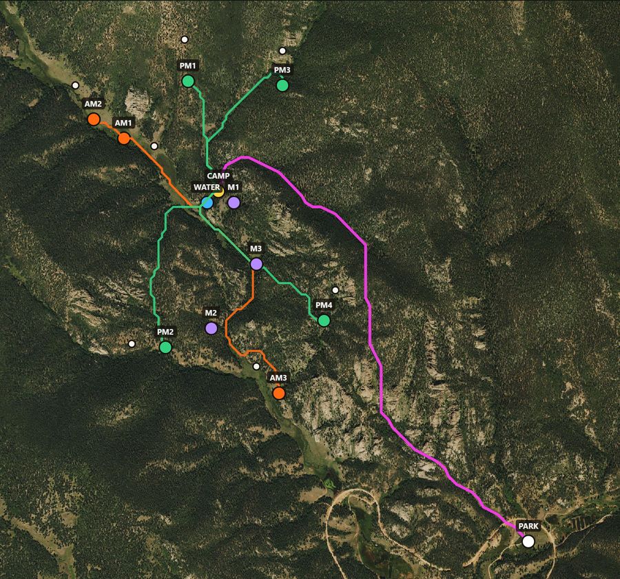 Real plan · GMU 59 · 3rd rifle elk
Tell us your tag and where you drive from. You get one exact plan: a legal place to leave the truck, a camp near water, morning and evening spots that watch feed, and the walk between them. It loads into the map app you already use.
Or hunt all year: the membership,
Real plan · GMU 59 · 3rd rifle elk
Two ways to hunt with FilledTag
A plan for your tag
Where to park, camp and sit for one tag, with the walking routes, the time to leave camp for every seat, and the map and field tools on that plan.
$39.99 once
Membership
The hunting map and field tools all year, for any ground in Colorado, with hunt plans as part of it.
Get a hunt plan for your tag
Purchase your plan first, then provide your hunt details. Free report requests are closed.
Looks like we can build a plan for your hunt.
Small game plans are free. This is for hunters who hold a Colorado small game license; after your hunt we will ask how it went.
Your answers are saved: after payment the rest of the form starts filled in. If no legal plan fits your tag and limits, you get a full refund.
We use your answers only to build and send your plan and to ask for your report. See the privacy page and terms.
A math engine, not AI. Every pin, mile, foot of climb and leave time is calculated from terrain and land records.
Built on more than 500 GB of mapped data for 186 Colorado units, from 16 public sources. Routes are not picked from a saved list: the walk from any legal camp to any legal seat is measured for your hunt. A second, independent check of delivered plans confirmed 1,847 pins and route points on public land and found none on private land.
“I looked at all the sit pins, and I have seen deer at or coming and going from every single one of those.”
No two hunters are sent to the same ground on the same days. What we promise
Founding members. Buy a plan, hunt it, and send the five-minute report linked from your plan page, good or bad. While places last, Colorado hunters who do become members for life: the membership and its three plans a year, with nothing to pay. places left.
Your plan goes with you, in the FilledTag app
The plan is not a page you leave at home. It opens on a hunting map on your phone, with every pin and route on it and how far each one is from where you stand.
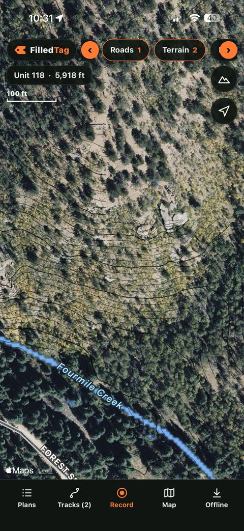
- Works with no signal. Save the ground before you leave service: aerial photo, topo, land ownership, water, forest roads and contour lines.
- Colorado, in layers. Hunting units, who manages the land, roads and trails, slope, what grows there, past fires and where each kind of game is mapped as living.
- Your own pins and paths. Mark a wallow, a rub or the truck, and find a walking path between two points with the distance and the climb.
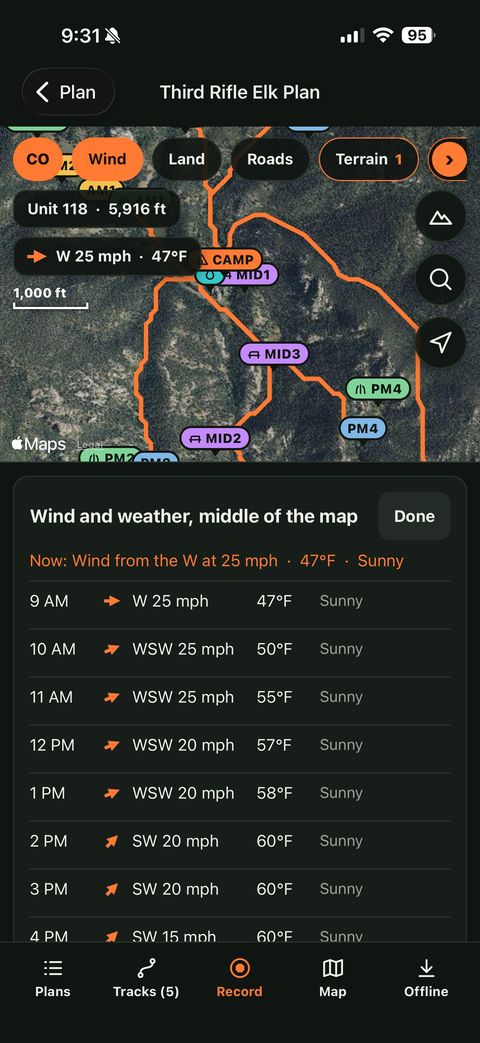
- Wind for the hours ahead, from the National Weather Service, for the spot you are looking at.
Get the iPhone app, free Open the map in your browser
The iPhone app is free. On Android, or on a computer, the same map runs in your browser.
Opening morning, already worked out
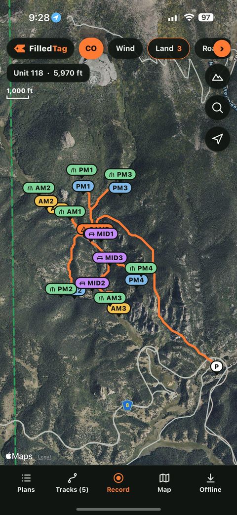
Most hunters spend the first two days of a five-day season finding out where to be. This is opening day from the sample plan, taken straight off the page.
Leave the tent
Seat AM2 is 0.56 miles and 78 feet of climb from camp, about 22 minutes in the dark. The route is in your map app as a track.
Sit down, 45 minutes early
You are in edge cover at , looking at a named piece of feed 225 yards out. The plan includes a drawing of what you see from this seat.
Legal light
Morning air drains downhill, away from the feed. If the wind is from the south-east, this seat is wrong, and the plan says so. Two other morning seats are waiting.
Leave for the evening seat
PM2 is 0.68 miles and 187 feet up, about 32 minutes. You are seated two hours before dark with a 198-yard shot.
Everything in the plan
- Park, camp and water: a legal place for the truck, a tent site off the road and water close by.
- Morning and evening seats that watch feed from cover, each with the shot, the time to leave camp and the wind that ruins it.
- Every walk measured inside the miles and climb you said you can do, and how far the meat goes back to the truck.
- Backup ground: up to three ranked areas, so a wrong wind, another party or snow does not end the hunt.
- Your unit's numbers and the rules for your tag, from Colorado Parks and Wildlife.
- On your phone with no signal, in the free iPhone app or any map app, with three reworks in the first seven days.
A map shows you the ground. This tells you what to do on it.
- Shows who owns each parcel
- Shows roads and trails
- Leaves the scouting, the camp and the seats to you
- Same for every hunter
- Knows the ground
- Costs thousands of dollars
- Hunts where they have a permit, on their dates
- Not what a do-it-yourself hunter wants
- Uses the map app you already have
- Picks the truck spot, camp and seats for you
- Fits your tag, your dates, your legs and your rifle
- Says what it checked and what it did not
Every pin is checked
- Each pin and each route is checked against public land ownership records. Anything not public is dropped.
- Roads are checked against Forest Service motor vehicle rules. Closed, private and gated roads are not used.
- Camps are kept off roads and trails and the right distance back from water.
- If we cannot find a legal plan that fits your limits, we say so. We do not loosen the rules to fill the page.
- It is a math engine, not AI. Nothing in a plan is written or guessed by a chatbot; every pin, distance, climb and leave time is calculated.
- It is new. This is its first season and it has not been proven in the field yet. We do not promise animal sightings or hunting success.
- It is fair chase. No animal locations, no cameras, no collars, nothing live and nothing crowdsourced. It tells you where you can legally park, camp and sit. You still have to hunt.
You still have to confirm land status, closures and regulations yourself before you hunt. Records can be wrong or out of date.
Look up your unit
In 2024, an estimated 121,786 rifle elk hunters hunted Colorado and 23% filled a tag. See how your unit compares: hunters, harvest and crowding by season.
From Colorado Parks and Wildlife harvest estimates. All units
Free Colorado hunting data: Elk units · Deer units · OTC elk units by the numbers · Hunt codes · Small game seasons · State Wildlife Area rules · Hunting map · Guides
Free: legal shooting hours for your unit and date, the rules for every State Wildlife Area, public land by unit, a pack-out calculator and a first-hunt course.
How it works
- 1
Check your hunt
Your tag, your unit and where you drive from. You see right away whether your unit is covered and roughly how far it is.
- 2
Choose a plan
One hunt, or a season pass for up to three. Payment by Stripe.
- 3
Finish the details
How far you will walk, camp, party and vehicle. About two minutes; your first answers are already filled in.
- 4
You get the plan
The plan and the map files by email. Most plans arrive the same day. Full refund if no legal plan fits.
Ready when you are
Six quick answers, free. You see whether your unit is covered and roughly how far it is before you pay anything.