Sheridan County walk-in hunting (WIHA): Kansas 2026-27 tracts, acres and map
Sheridan County has 63 Walk-In Hunting Access tracts on KDWP's 2026-27 map, 19,325 acres in all, 3.4% of the county's land. That ranks 18th of Kansas's 105 counties for WIHA acres. Most tracts are open Sept. 1 to Jan. 31 (36 tracts). 4 tracts are archery and shotshell only.
Data updated October 2026. Walk-in: KDWP's Walk-In Hunting Access layer for 2026-27. Land: USGS PAD-US 4.1 and agency area maps.
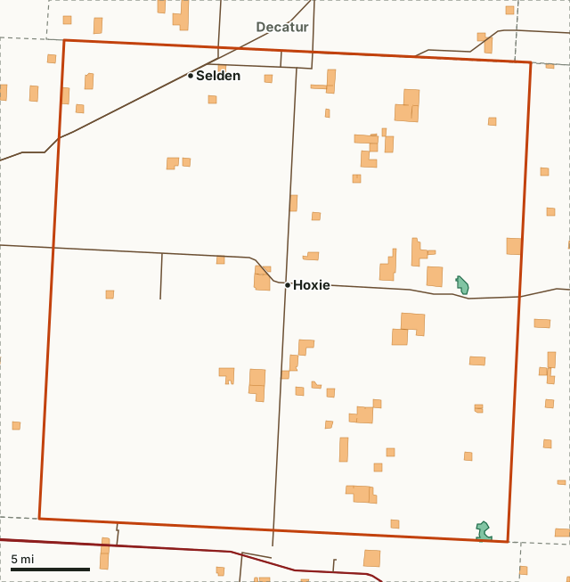
KDWP landOther publicWalk-in (WIHA)Sheridan CountyWildlife areaLakeHighway
| WIHA tracts, 2026-27 | 63 |
|---|---|
| WIHA acres | 19,325 (3.4% of the county) |
| Largest tracts | 1,068, 870, 800, 689, 680 acres |
| Public land | 779 acres (0.1%) |
| Deer units | Unit 1 |
| KDWP region | Region 1 |
| Towns | Hoxie and Selden |
When are Sheridan County's walk-in tracts open?
Each WIHA tract is open to the public only during its lease period, shown on the sign at the tract and in KDWP's atlas. Sheridan County's 63 tracts by lease period:
| Lease period | Tracts | Acres |
|---|---|---|
| Sept. 1 to Jan. 31 | 36 | 11,646 |
| Nov. 1 to Jan. 31 | 21 | 5,764 |
| Sept. 1 to May 31 | 6 | 1,915 |
4 tracts (1,155 acres) are marked archery and shotshell only, so no rifle or slug hunting there. Tracts open until May 31 or March 31 cover the spring turkey season or late winter; tracts that close Jan. 31 do not.
Lease periods and the archery/shotshell mark: KDWP Walk-In Hunting Access (WIHA) tracts (KDWP's legend codes, read against its 2026 contract list).
What does KDWP list on the tracts?
Species named in KDWP's tract records for Sheridan County, by number of tracts: deer 50, pheasant 49, turkey 7, dove 4, other 2 and prairie chicken 1. A tract with no species named is still open to all hunting in season during its lease period.
Where are the biggest walk-in tracts in Sheridan County?
The 12 largest tracts on KDWP's 2026-27 map, each placed by the nearest town:
| Acres | Where | Deer unit | Lease period | Notes |
|---|---|---|---|---|
| 1,068 | 8 mi east of Hoxie | Unit 1 | Sept. 1 to Jan. 31 | Species listed: deer, prairie chicken |
| 870 | 6 mi east of Hoxie | Unit 1 | Sept. 1 to Jan. 31 | Species listed: deer, pheasant |
| 800 | 9 mi east of Hoxie | Unit 1 | Nov. 1 to Jan. 31 | |
| 689 | 9 mi southeast of Dresden | Unit 1 | Sept. 1 to Jan. 31 | Species listed: deer, turkey, pheasant |
| 680 | 9 mi east of Hoxie | Unit 1 | Nov. 1 to Jan. 31 | Species listed: deer, pheasant |
| 640 | 9 mi southeast of Dresden | Unit 1 | Sept. 1 to Jan. 31 | Species listed: deer, pheasant |
| 640 | 6 mi south of Hoxie | Unit 1 | Sept. 1 to Jan. 31 | Species listed: deer, pheasant, dove |
| 640 | 8 mi southeast of Hoxie | Unit 1 | Sept. 1 to Jan. 31 | |
| 640 | 6 mi northwest of Morland | Unit 1 | Sept. 1 to Jan. 31 | Species listed: deer, pheasant |
| 640 | 4 mi north of Park | Unit 1 | Sept. 1 to May 31 | Species listed: deer, turkey, pheasant, dove |
| 605 | 2 mi west of Hoxie | Unit 1 | Sept. 1 to Jan. 31 | Archery and shotshell only; Species listed: deer, pheasant, dove |
| 480 | 9 mi northeast of Hoxie | Unit 1 | Sept. 1 to Jan. 31 | Species listed: deer, pheasant |
Tracts: KDWP Walk-In Hunting Access (WIHA) tracts; towns: U.S. Census Bureau 2024 Gazetteer, places. Use KDWP's Hunting Atlas or the Go Outdoors Kansas app to find each tract's signs and parking.
What public land is in Sheridan County?
USGS PAD-US 4.1 and KDWP area maps show 779 acres of public land in the county, 0.1% of it. The walk-in tracts cover more ground: 19,325 acres. Wildlife areas with a page: Sheridan Wildlife Area (437 acres here) and Sheridan State Fishing Lake and Wildlife Area (324 acres here).
| Manager | Acres | Share of the county |
|---|---|---|
| KDWP land | 779 | 0.1% |
| Other public (not counted as hunting land) | 22 | under 0.1% |
Measured by FilledTag inside the Census county line from USGS PAD-US 4.1 (fee and designation lands with open or restricted public access) and KDWP wildlife areas; the water of the larger reservoirs is left out.
Which deer units cover Sheridan County?
All of Sheridan County is in Unit 1. A deer hunter on a walk-in tract needs a permit valid in the unit the tract lies in.
| Deer unit | Share of the county | Deer harvested (whole unit) | WIHA acres (whole unit) |
|---|---|---|---|
| Unit 1 | 100% | 1,830 (2021) | 170,924 |
How does Sheridan County compare with the counties around it?
Walk-in acres and public land in the 5 counties that touch Sheridan County, most walk-in land first:
| County | WIHA acres | WIHA tracts | Public land |
|---|---|---|---|
| Thomas County | 32,327 | 98 | 0% |
| Graham County | 29,209 | 111 | 0% |
| Gove County | 23,266 | 58 | 0% |
| Decatur County | 22,913 | 41 | 0% |
| Norton County | 14,404 | 52 | 1% |
Questions hunters ask
How many walk-in hunting acres are in Sheridan County, Kansas?
19,325 acres on 63 tracts on KDWP's 2026-27 Walk-In Hunting Access map, 3.4% of the county.
Can you deer hunt on WIHA in Sheridan County?
Yes, during each tract's lease period and the deer seasons, with the permit for the deer unit the tract is in (Unit 1). 4 tracts are archery and shotshell only. WIHA tracts take walk-in hunters only; trapping is not part of the program.
Is there public land in Sheridan County?
779 acres, 0.1% of the county, by USGS PAD-US 4.1 and KDWP area maps, mostly KDWP land. Wildlife areas here: Sheridan Wildlife Area and Sheridan State Fishing Lake and Wildlife Area.
Walk-in rules to know
- No access outside a tract's lease period; stay inside the tract's signed boundary.
- Walk-in only: park where it does not block roads, gates or driveways.
- No baiting, trail cameras or commercial guiding; trapping is not part of WIHA.
- iWIHA tracts need check-in and check-out in the Go Outdoors Kansas app.
Source: KDWP's Fall 2026-Spring 2027 Hunting & Furharvesting Regulations Summary, page 56 and page 7.
Get a Kansas hunt plan when they open
Hunt plans for Kansas are coming. Join the list and you'll hear first. The first 50 hunters in each new state get their plan free.
Until then, the free FilledTag app for iPhone has a map that works in every state, Kansas included.
Where these numbers come from
- Walk-in tracts: KDWP Walk-In Hunting Access (WIHA) tracts.
- Public land: USGS PAD-US 4.1. County line: U.S. Census Bureau 2024 cartographic boundary counties.
- Deer unit harvest: KDWP deer harvest by unit (2017 to 2021).
FilledTag is not part of Kansas Department of Wildlife and Parks. Tracts change every season; the sign on the tract is the final word.