Oregon's Columbia zone: hunting units, harvest and public land
ODFW's Columbia zone has 4 wildlife management units and is 24.6% public land, by USGS PAD-US. Adding up ODFW's rows for its units, hunters took 442 elk and 1,434 deer here in 2025, and 12 pronghorn.
Data updated October 2026. Harvest: ODFW, 2020 to 2025. Land: USGS PAD-US 4.1. Seasons: ODFW's 2026 regulations.
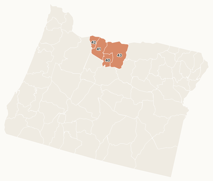
ODFW's Columbia zone takes in the east side of Mount Hood and the country down to the Columbia River: the Hood, White River, Maupin and Biggs units.
Which units are in the Columbia zone?
Every unit in the zone with ODFW's 2025 harvest and its public land. The most elk were taken in Unit 41 White River (199), Unit 43 Biggs (131) and Unit 42 Hood (72). The most public land: Unit 42 (63.8%), Unit 41 (43.4%) and Unit 43 (12.3%).
| Unit | Name | Square miles | Public land | Elk, 2025 | Deer, 2025 | Pronghorn, 2025 |
|---|---|---|---|---|---|---|
| Unit 40 | Maupin | 529 | 9.3% | 40 | 124 | |
| Unit 41 | White River | 940 | 43.4% | 199 | 527 | |
| Unit 42 | Hood | 376 | 63.8% | 72 | 104 | |
| Unit 43 | Biggs | 1,974 | 12.3% | 131 | 679 | 12 |
Harvest: ODFW harvest statistics (2020 to 2025), ODFW's rows for each unit added up across general and controlled tags. Public land measured by FilledTag from USGS PAD-US 4.1 (fee land by manager, 2025).
Controlled hunts in the Columbia zone with their own page
10 hunts with three or more years of ODFW harvest and a 2026 draw report, most tags first:
- 241Y White Rvr - Hood No. 2, elk, 1,210 tags
- 244 Columbia Plateau, elk, 1,100 tags
- 241X White Rvr - Hood No. 1, elk, 550 tags
- 241C White Rvr Private, elk, 231 tags
- 242 Hood Private, elk, 83 tags
- 241B White Rvr - Hood, elk, 55 tags
- 440A1 Columbia Plateau No. 1, pronghorn, 55 tags
- 241T White Rvr - Hood Youth, elk, 40 tags
- 241A The Dalles Watershed, elk, 33 tags
- 440A2 Columbia Plateau No. 2, pronghorn, 26 tags
Wildlife areas and access areas in the Columbia zone
- Lower Deschutes Wildlife Area: 18,696 acres
- White River Wildlife Area: 29,803 acres
Get an Oregon hunt plan when they open
Hunt plans for Oregon are coming. Join the list and you'll hear first. The first 50 hunters in each new state get their plan free.
Until then, the free FilledTag app for iPhone has a map that works in every state, Oregon included.
Sources: ODFW harvest statistics (2020 to 2025); USGS PAD-US 4.1 (fee land by manager, 2025); ODFW Wildlife Management Units (Compass dataset); ODFW 2026 Oregon Big Game Hunting Regulations. FilledTag is not part of Oregon Department of Fish and Wildlife.
Oregon hunting Northwest Southwest Central Northeast Southeast South Central